Mount Pleasant 1882 – Kew
$16.50 – $49.50
Mount Pleasant 1882 – Kew
The copyright watermark will not appear on the finished print. Hover you cursor over the map for an enlarged view.
Description
A classical map from 1882. I could not find any reference to the shading on some of the lots but given names were penciled in they may have already been sold prior to the auction. In the advertising for the auction the auctioneer was keen to draw people’s attention to the depth of some blocks, over 400 feet. The area of the development is bounded on the north side by Molesworth Street, in the east by Princess Street, in the south by both sides of Abeckett Street and Conran (now Holroyd) Street. In 1882 the western boundary was the Yarra River. Barry Street and Wills Street ( now Studley Avenue) run through the development. Given the depth of many blocks there has been further subdivision.
Additional information
| Dimensions | N/A |
|---|---|
| Size | A4 (Small), A3 (Medium), A2 (Large) |
Related products
-
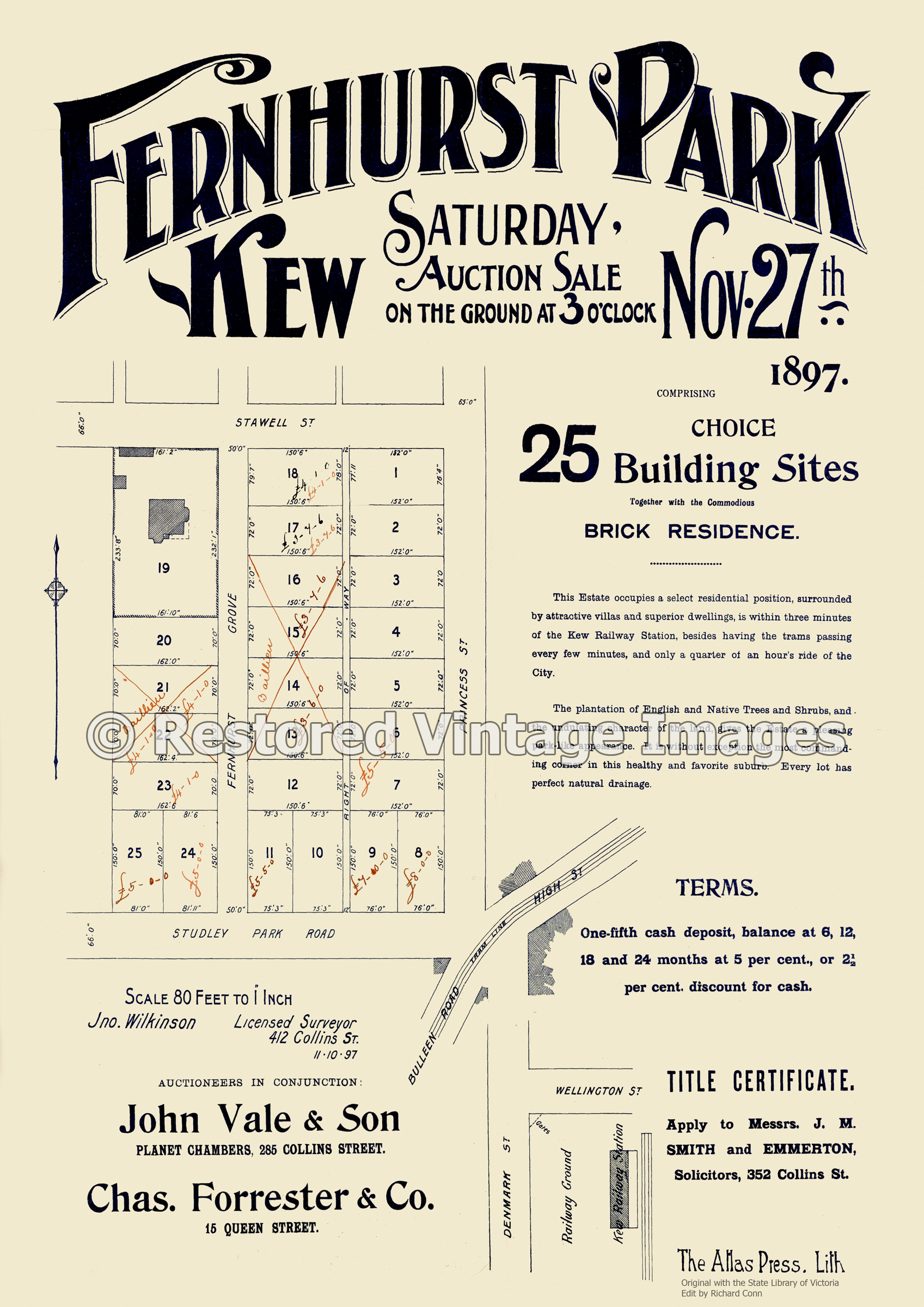
Fernhurst Park 1897 – Kew
$16.50 – $49.50 -
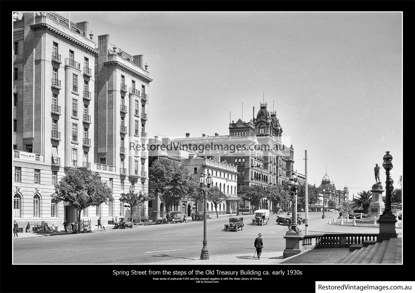
Spring Street 1930s
$16.50 – $49.50 -
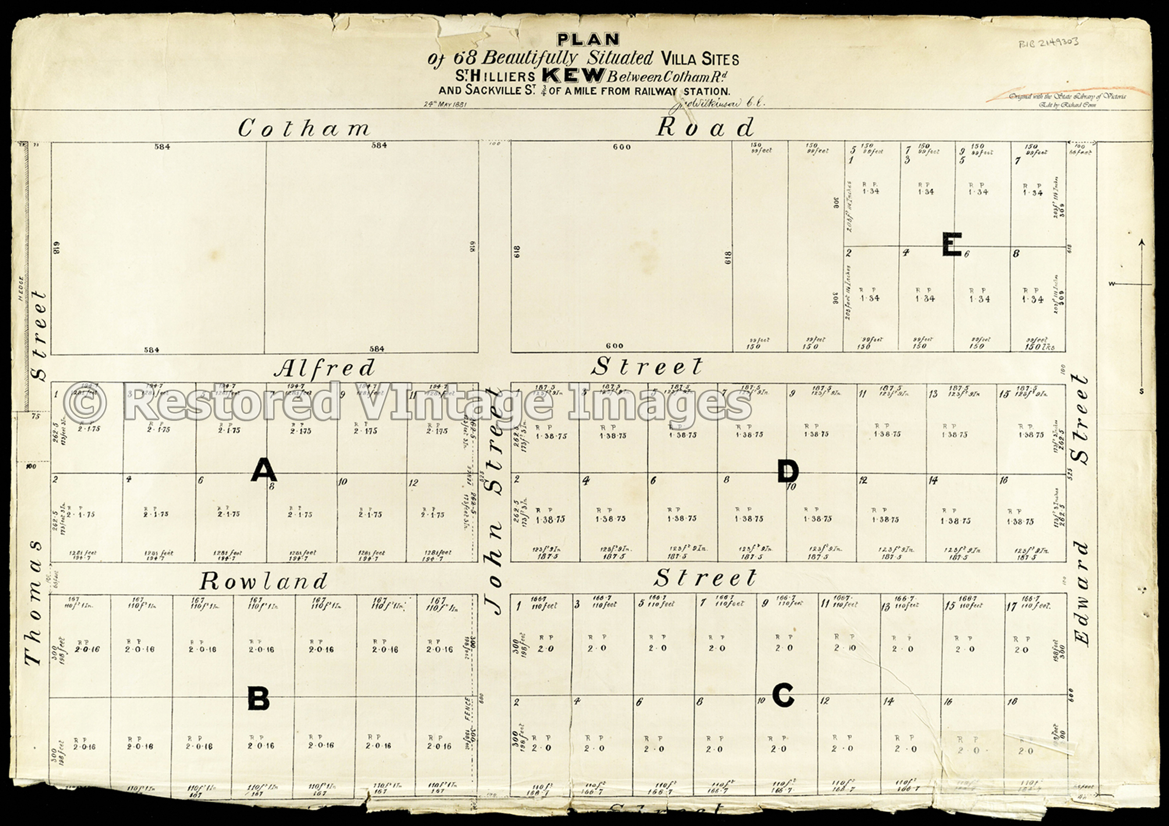
St Hilliers May 1881 – Kew
$16.50 – $49.50 -
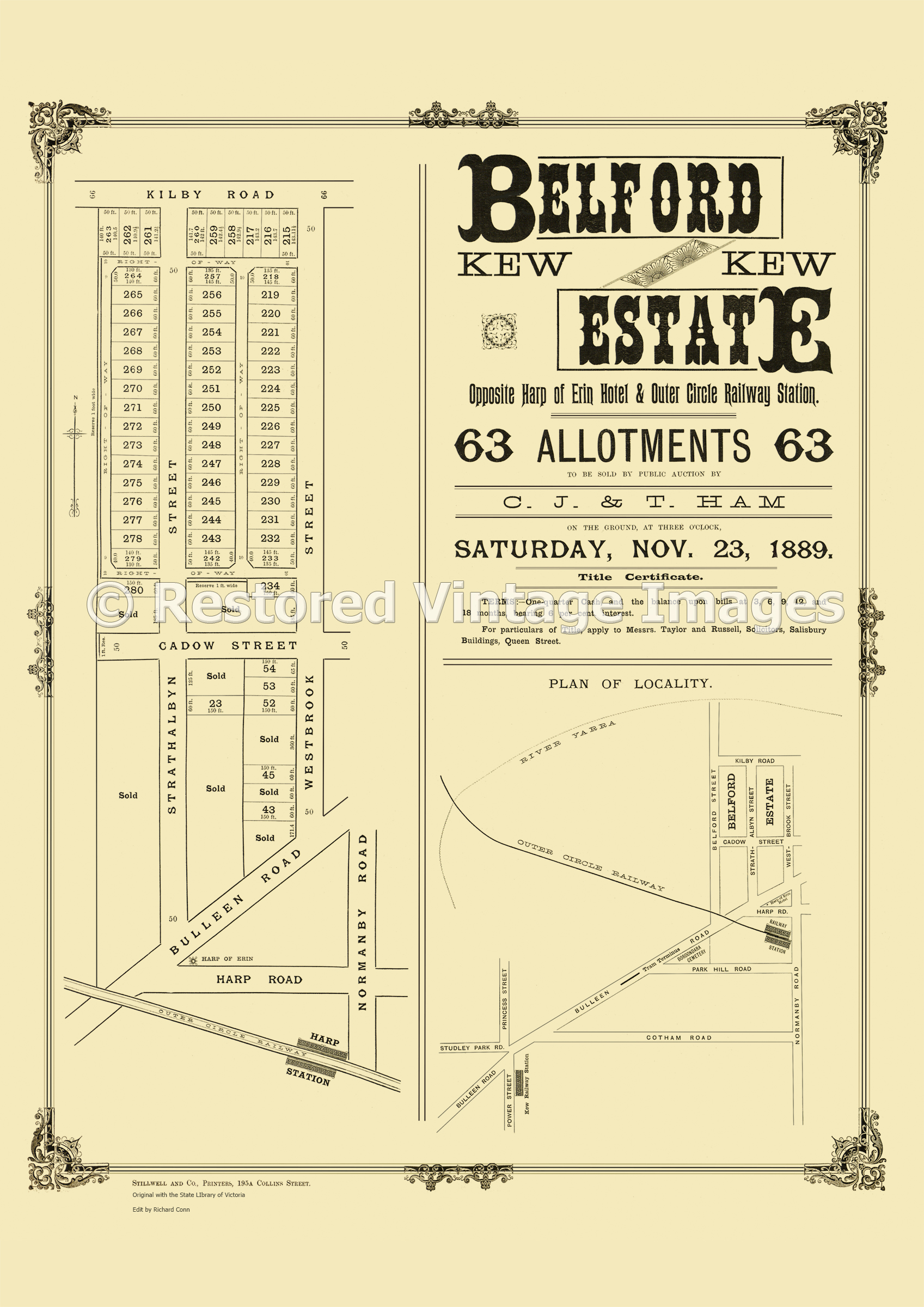
Belford Estate Kew 23rd November 1889 – Kew East
$16.50 – $49.50