Post Office Extension Estate 4th August 1888 – Burwood
$16.50 – $49.50
Post Office Extension Estate 4th August 1888 – Burwood
The copyright watermark will not appear on the finished print. Hover you cursor over the map for an enlarged view.
Description
Some maps are hard to match with the ground, north does not point to the top of the page, roads have changed their names or are just called “Boundary”. North is out to the right, towards Burwood Road, there is a Boundary Road to the west and to the south and there is a Government Road on the eastern boundary/edge. The light goes on! The southern road is now Highbury Road, the western road is Warrigal (it was officially called Boundary Road at one time) and the Government Road is Gilmour Street. Scott Street is now a Grove and Clark Street has been chopped about and may now be Church Street.
Additional information
| Dimensions | N/A |
|---|---|
| Size | A4 (Small), A3 (Medium), A2 (Large) |
Related products
-
Surrey Hills Auction 1888 – Rosalie Estate
$16.50 – $49.50 -
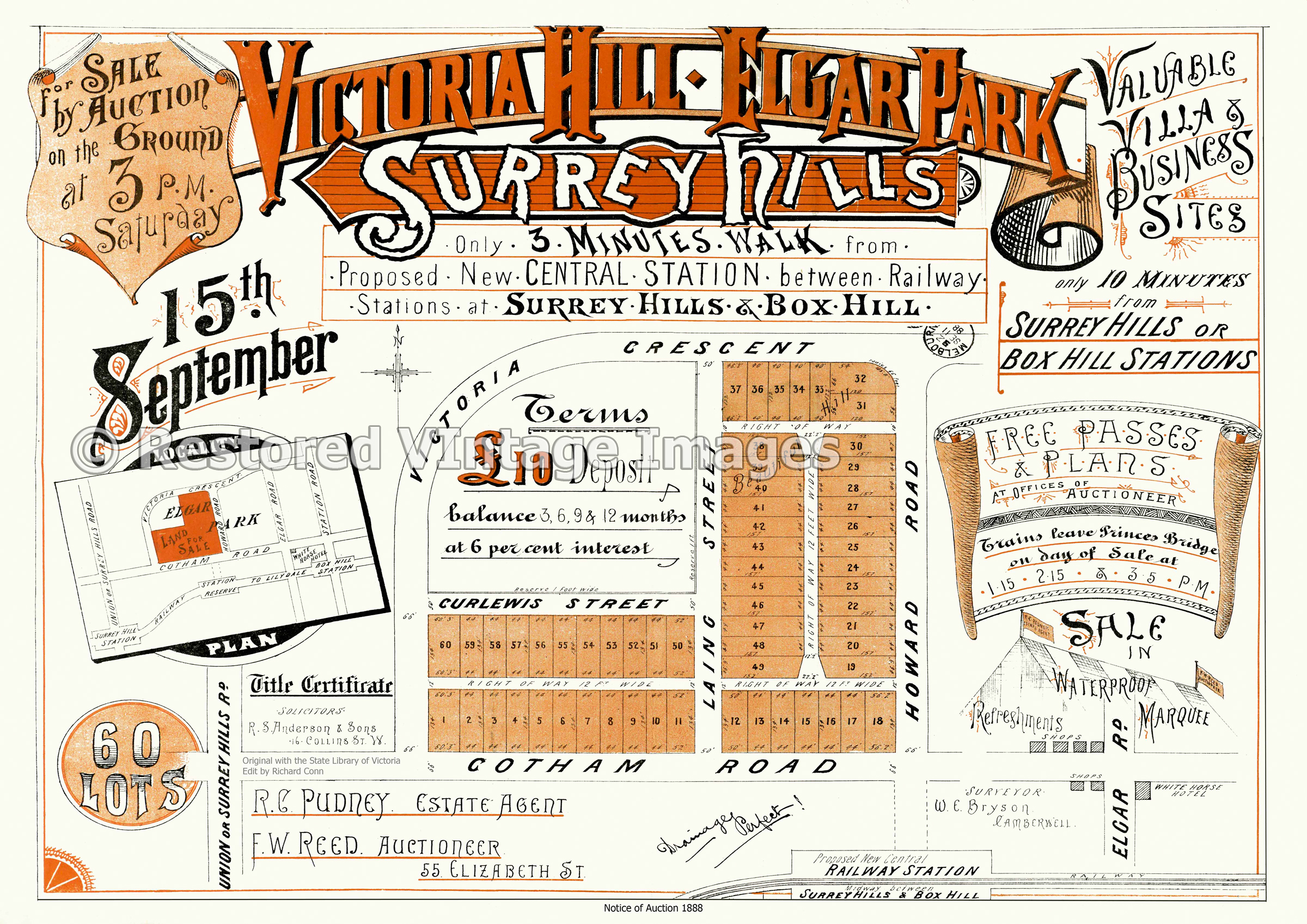
Victoria Hill – Elgar Park Estate 1888
$16.50 – $49.50 -
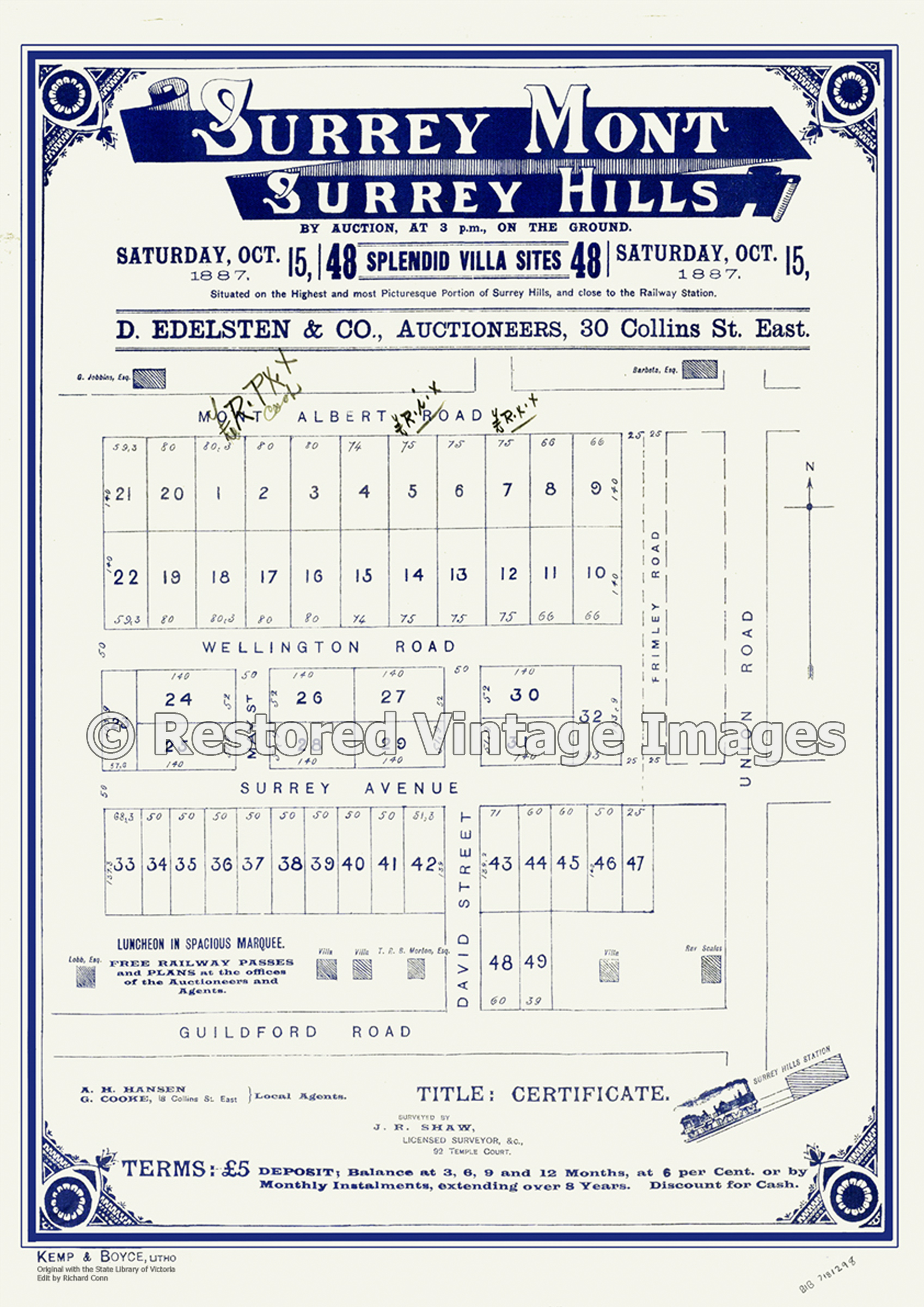
Surrey Mont Estate 1887 – Surrey Hills
$16.50 – $49.50 -
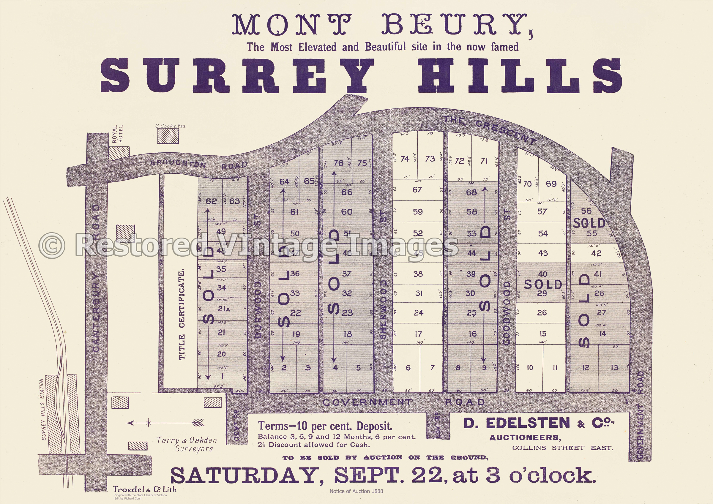
Mont Beury Surrey Hills 1888
$16.50 – $49.50