Plan of Subdivision Frankston 1870-90
$16.50 – $49.50
Plan of Subdivision Frankston 1870-90
The copyright watermark will not appear on the finished print. Hover you cursor over the map for an enlarged view.
Description
This development is bounded by Hastings Road in the south, Clarendon Road in the west, Frankston Memorial Park in the north and Moorooduc Highway in the east. Burns Street has yet to be invented and will run north/south through the block. The 37 lots vary in size from very close to half an acre to just under an acre.
Additional information
| Dimensions | N/A |
|---|---|
| Size | A4 (Small), A3 (Medium), A2 (Large) |
Related products
-
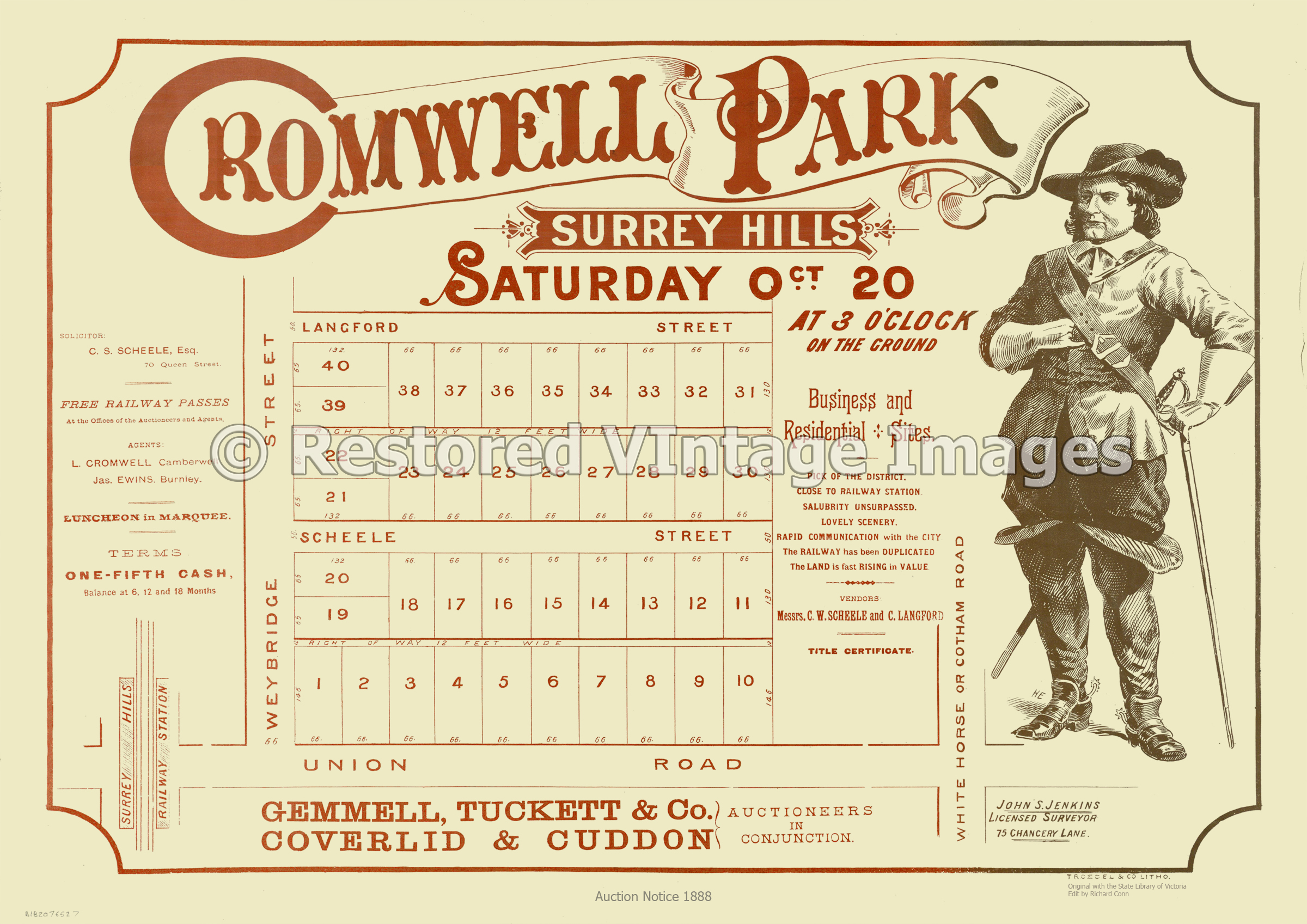
Cromwell Park Estate 1888 – Surrey Hills
$16.50 – $49.50 -
Surrey Hills Auction 1888 – Rosalie Estate
$16.50 – $49.50 -
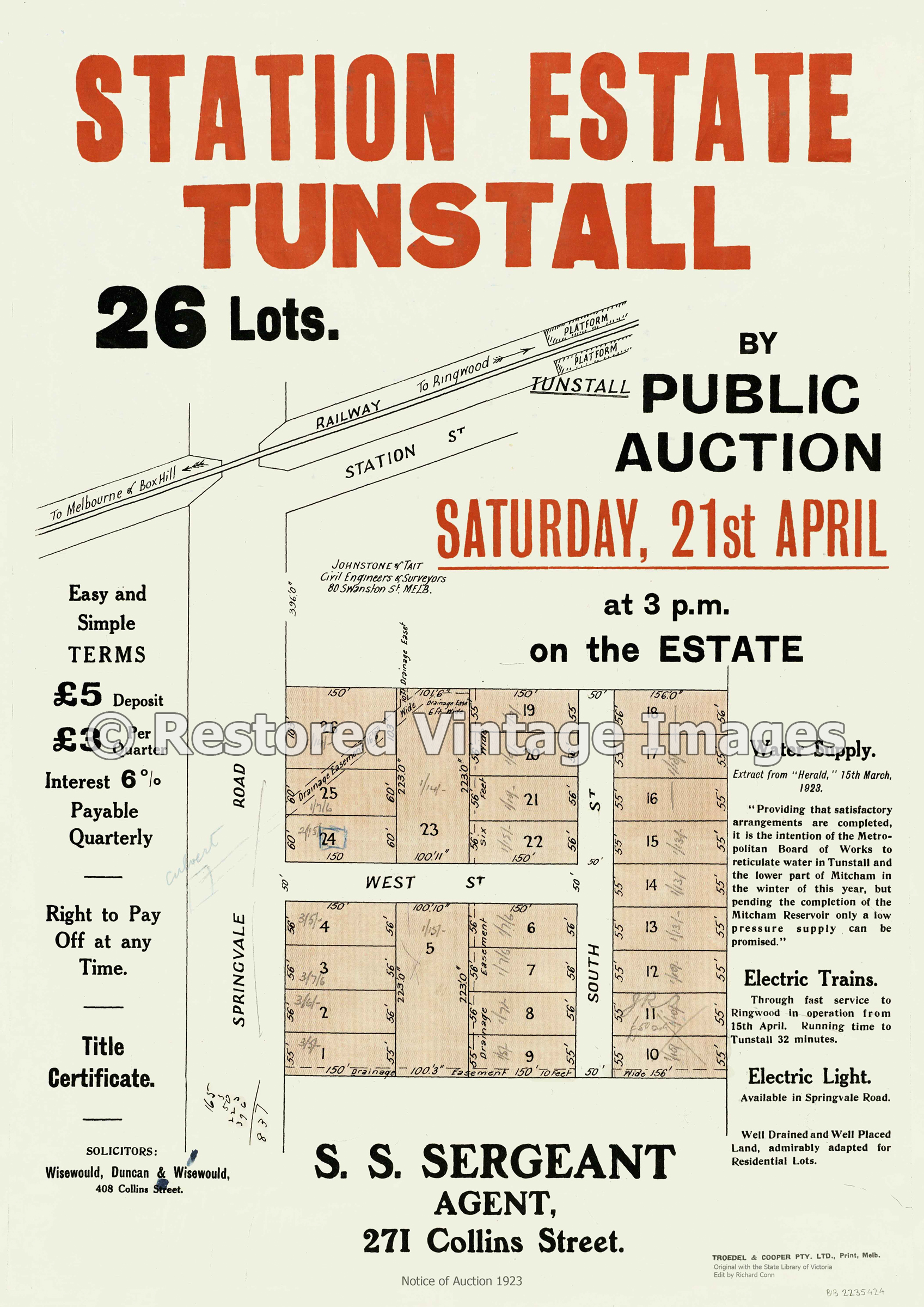
Tunstall Station Estate 1923
$16.50 – $49.50 -
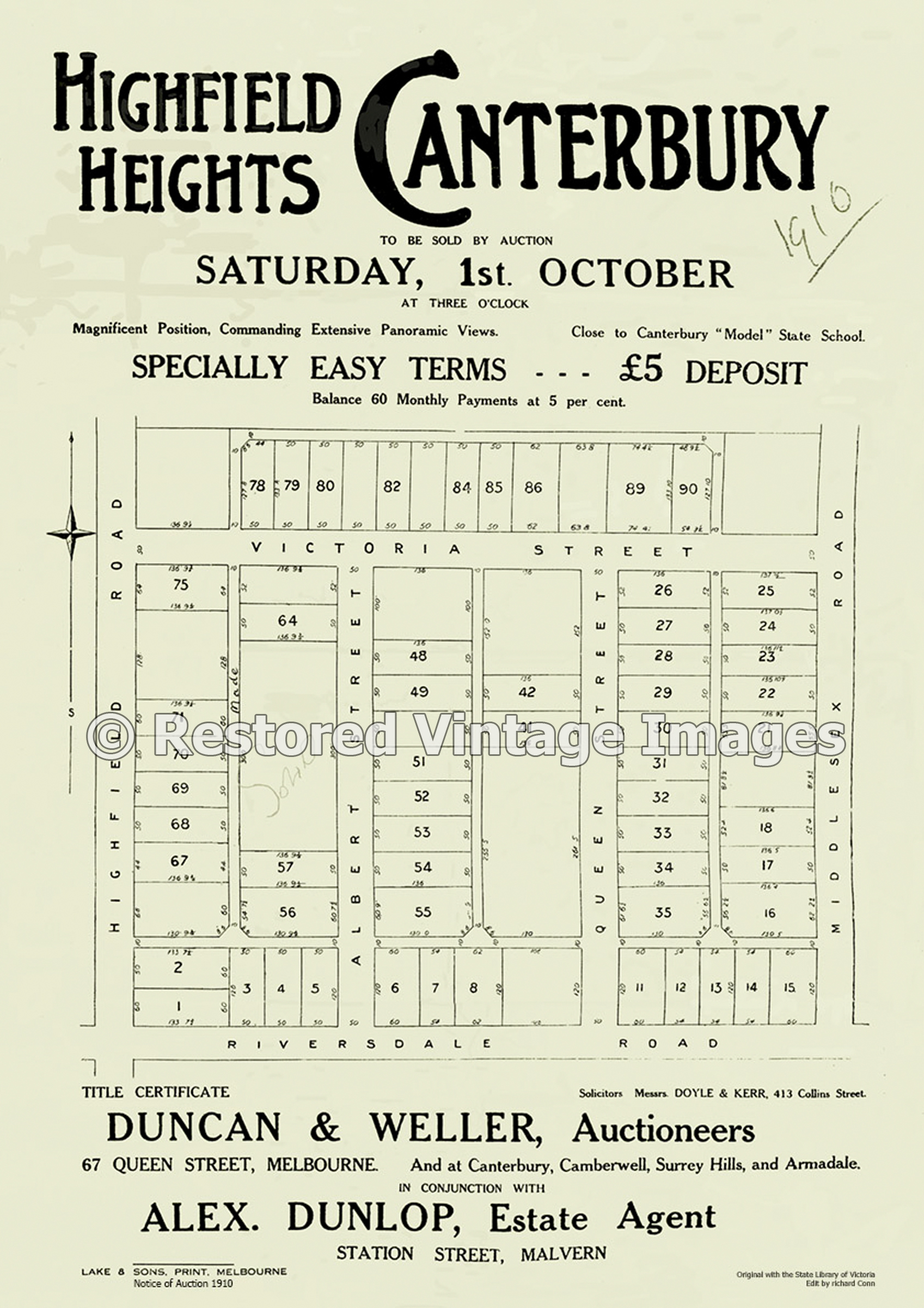
Highfield Heights, Canterbury
$16.50 – $49.50